|
The Second GEODETIC LEVELLING of ENGLAND & WALES 1912-1921 Published, by Order of the Ministry of Agriculture and Fisheries, by Colonel Sir Charles Close, KBE, CB, CMG, FRS Director-General of the Ordnance Survey, Southampton 1921 |
|||
|
[Companion volume to the '2GL Abstract' - Original Index] |
|||
| Contents * | |||
| Introduction | 4 | ||
| I | (AJW) | History of the Ordnance Survey Levelling | 7 |
| II | (AJW) | Instruments | 11 |
| III | (AJW) | Methods of Observation | 15 |
| IV | (HLPJ) | Orthometric and Dynamic Corrections | 19 |
| V | (AJW) | Tidal Observations | 24 |
| VI | (HLPJ) | Mean Sea Level | 30 |
| VII | (HLPJ) | Effect of Meteorological Conditions on the level of the sea | 35 |
| VIII | (HLPJ) | The errors of levelling and the method of reduction | 39 |
| VIX | (HLPJ) | Reduction of the observations of the level net | 55 |
|
PLATES (gallery) |
|||
| I | Diagram of network of 1st Geodetic Levelling. | ||
| II | Diagram of network of 2nd Geodetic Levelling. | ||
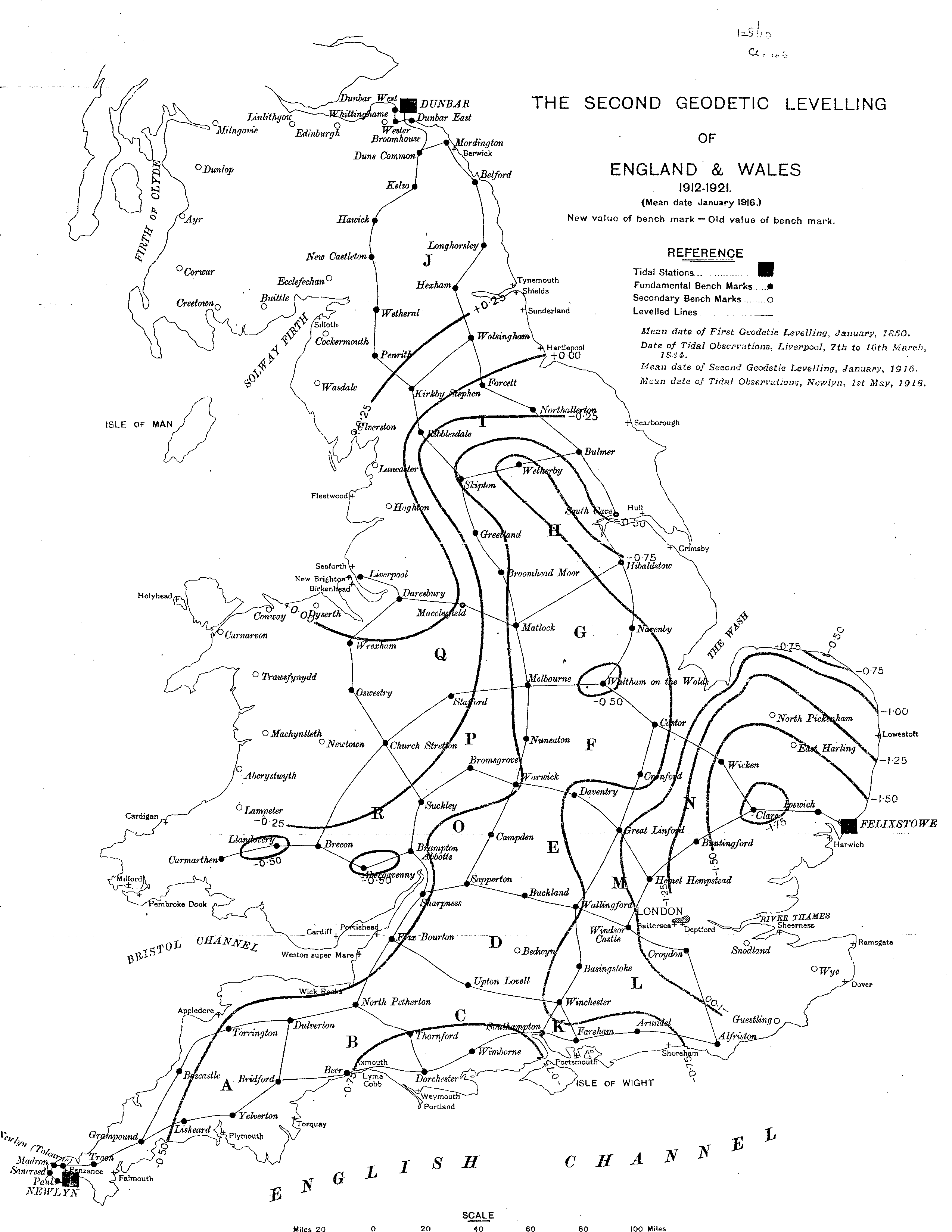
| III | Diagram of difference of level of old and new levelling | ||
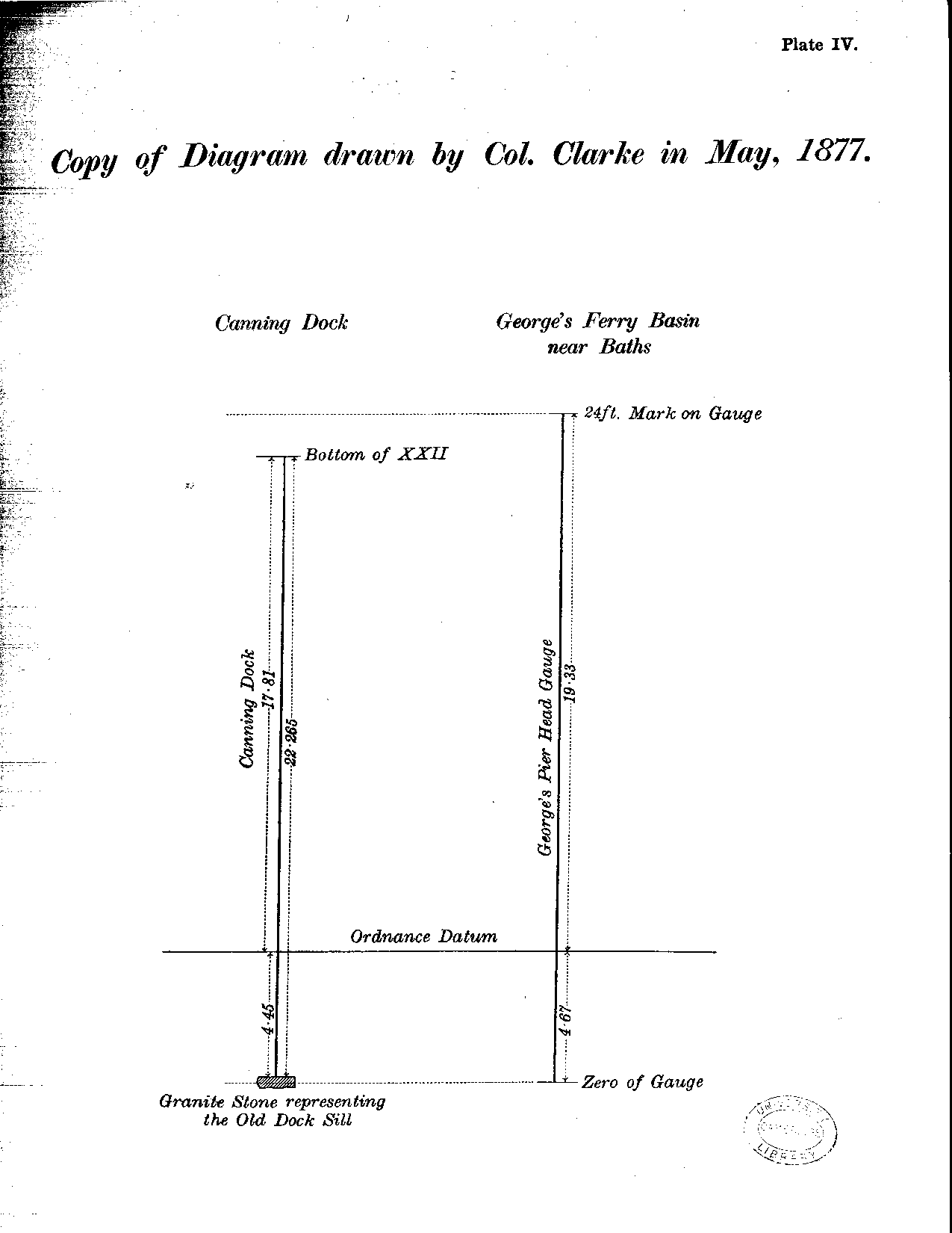
| IV | Diagram of Tidal Gauges, Liverpool | ||
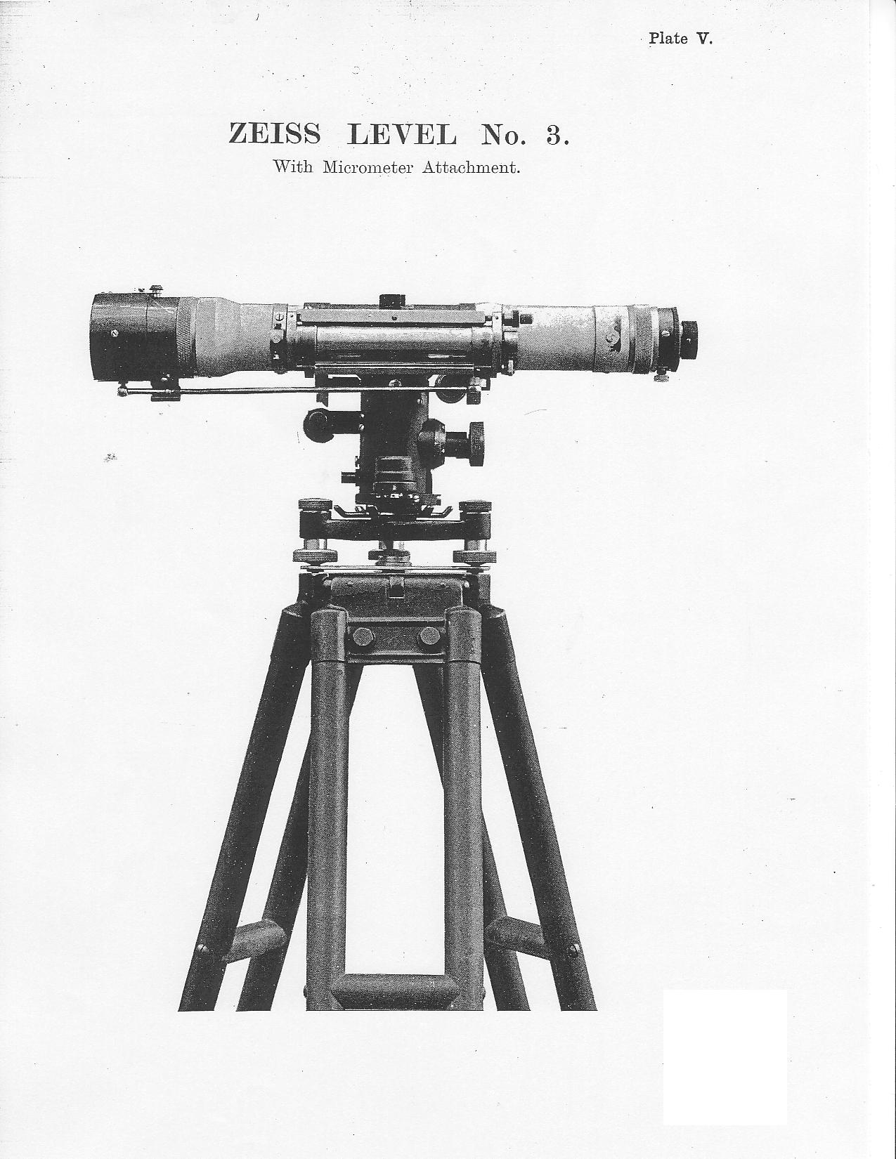
| V | Zeiss Level | ||
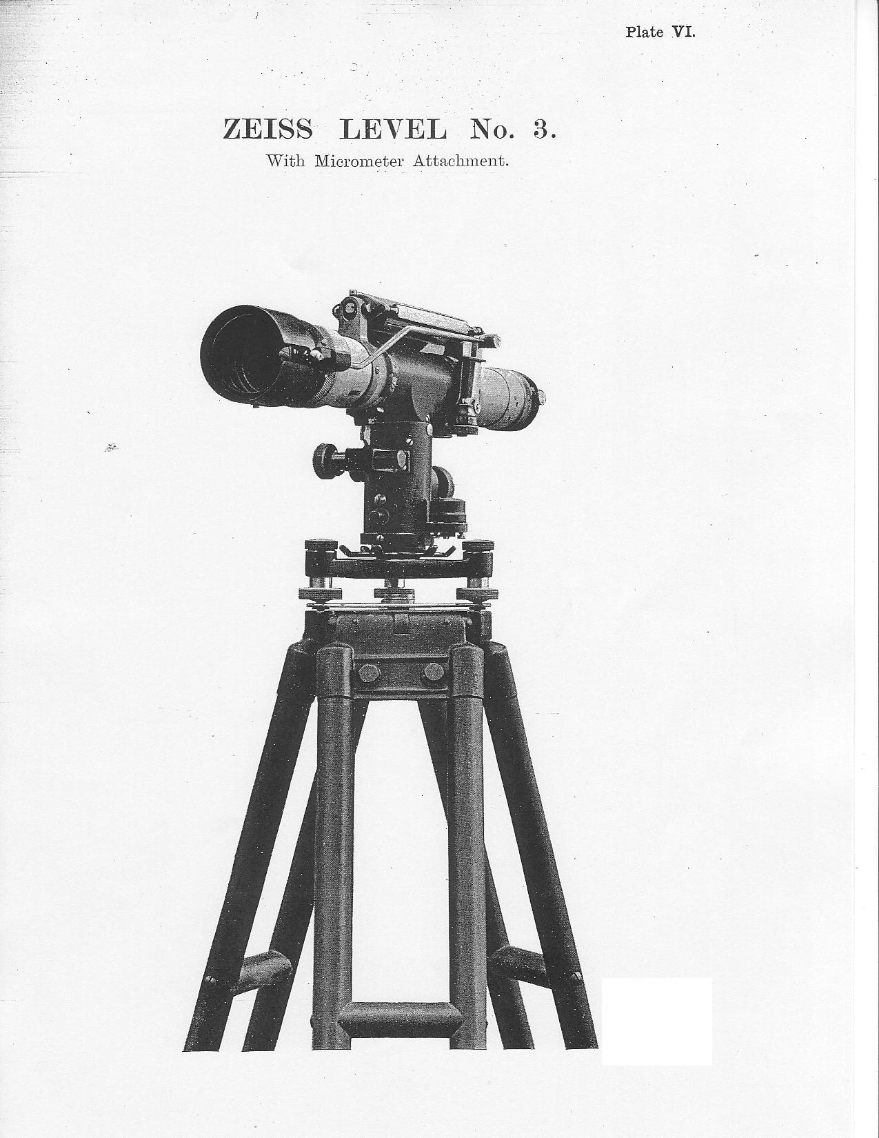
| VI | Zeiss Level | ||
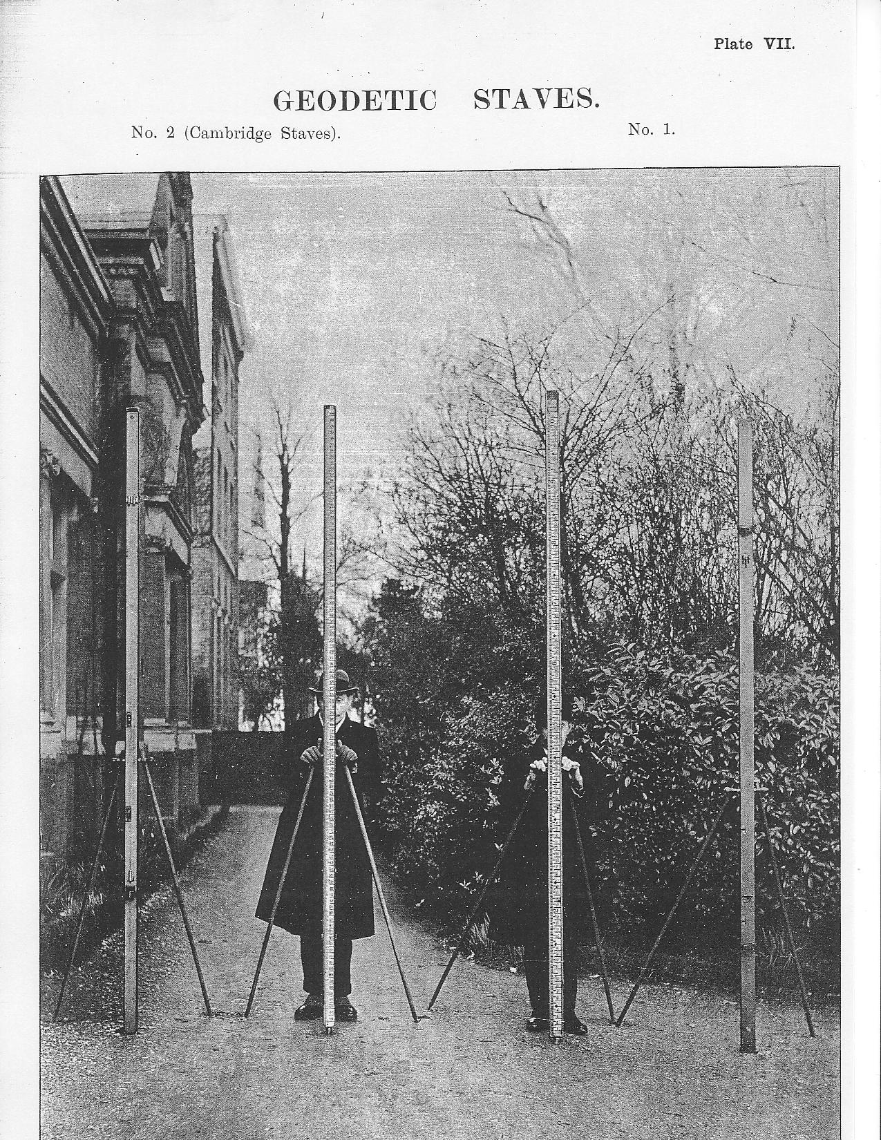
| VII | Geodetic Staves | ||
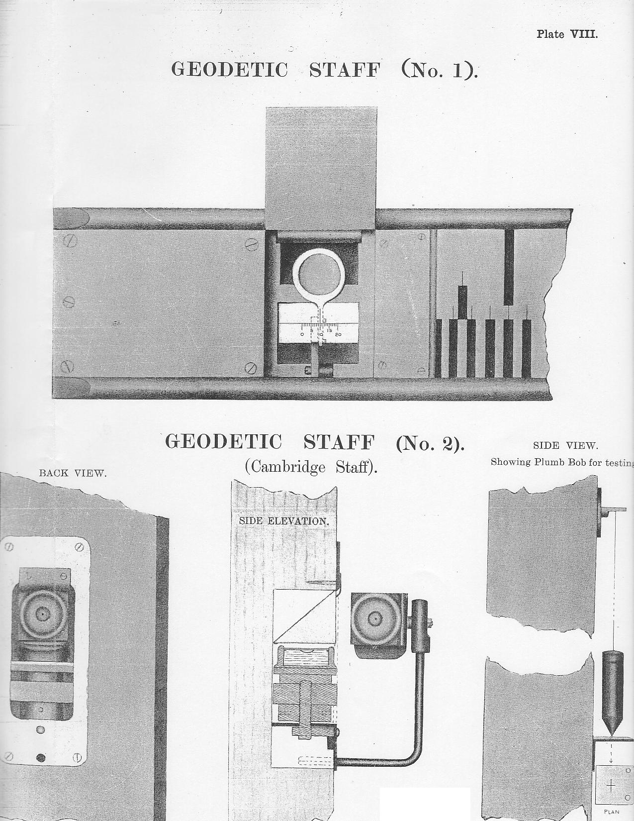
| VIII | Details of Geodetic Staves | ||
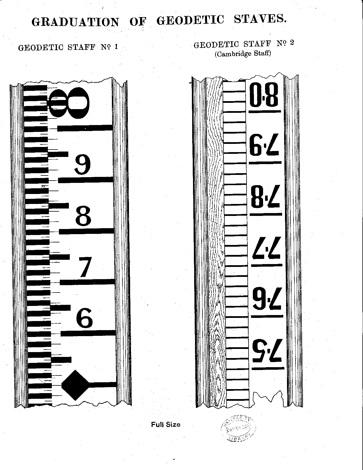
| IX | Graduation of Geodetic Staves | ||
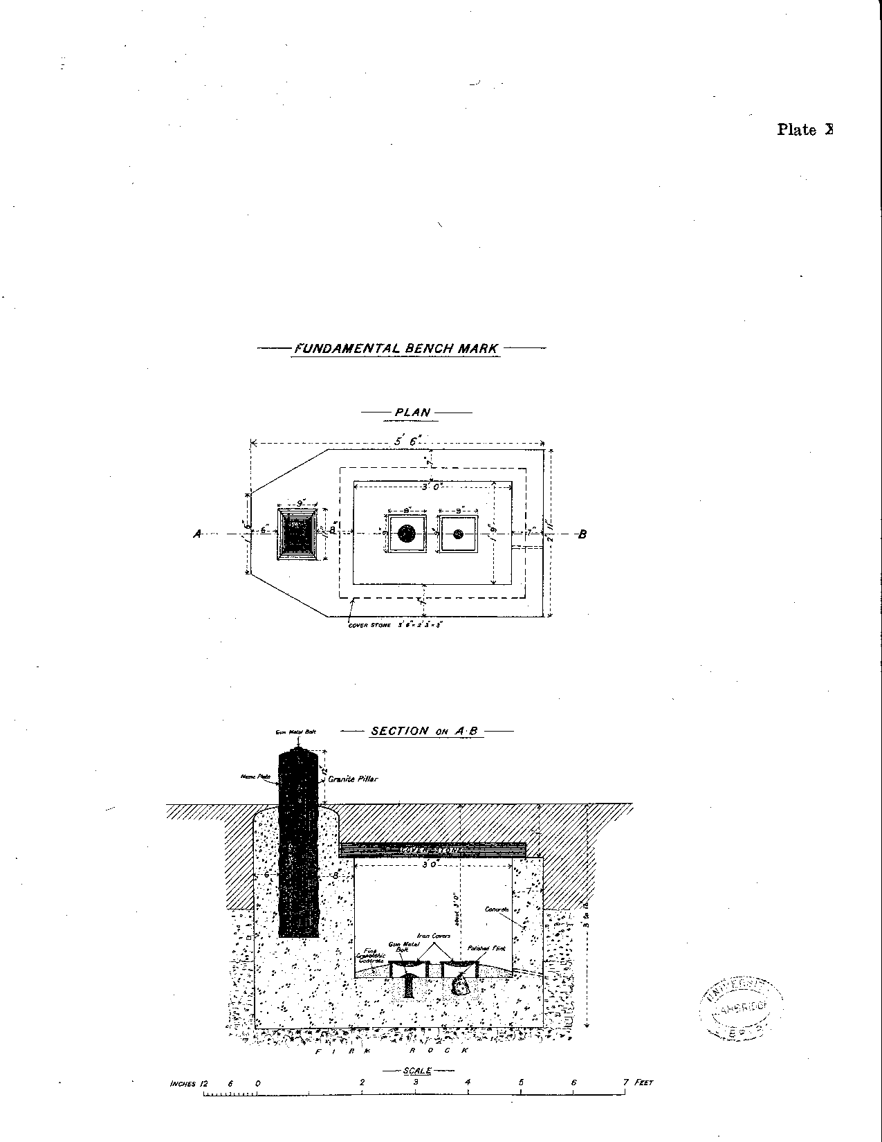
| X | Fundamental Bench Mark | ||
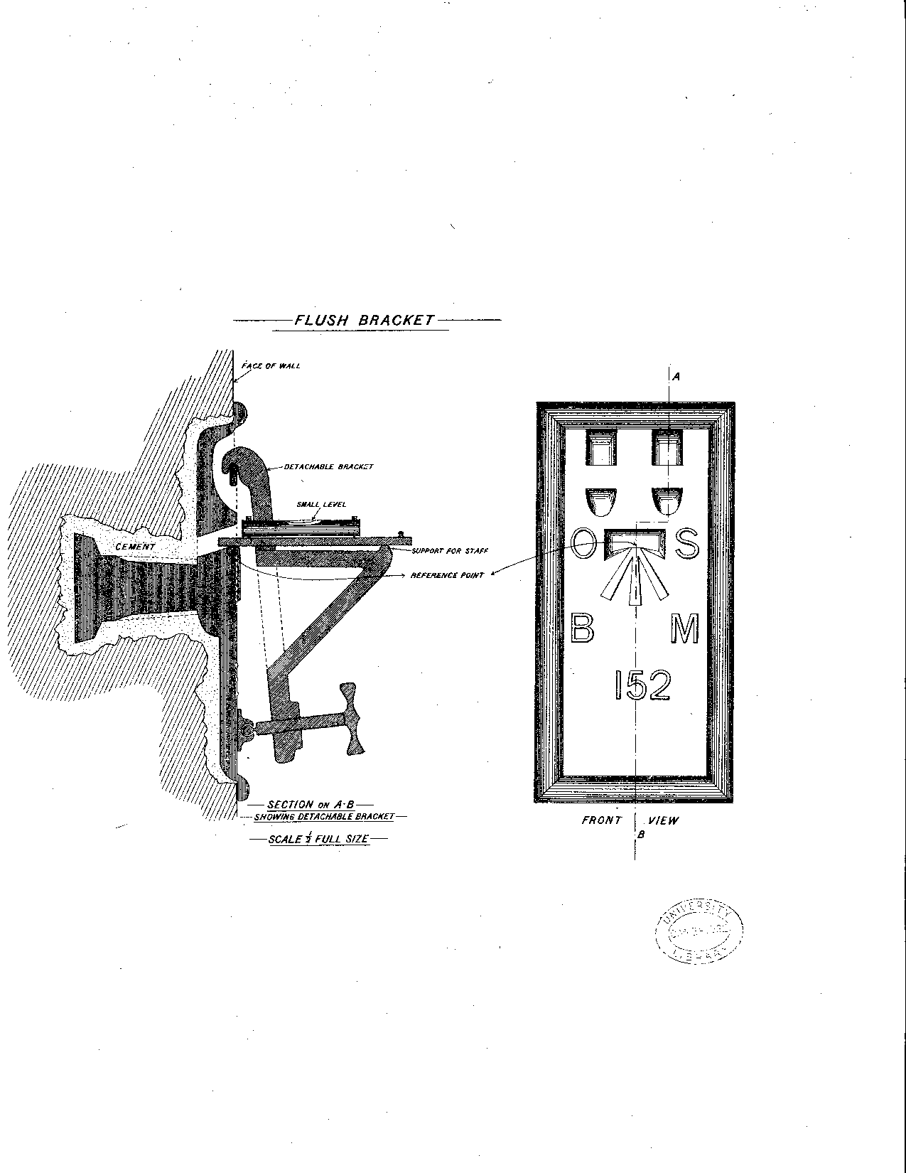
| XI | Flush Bracket | ||
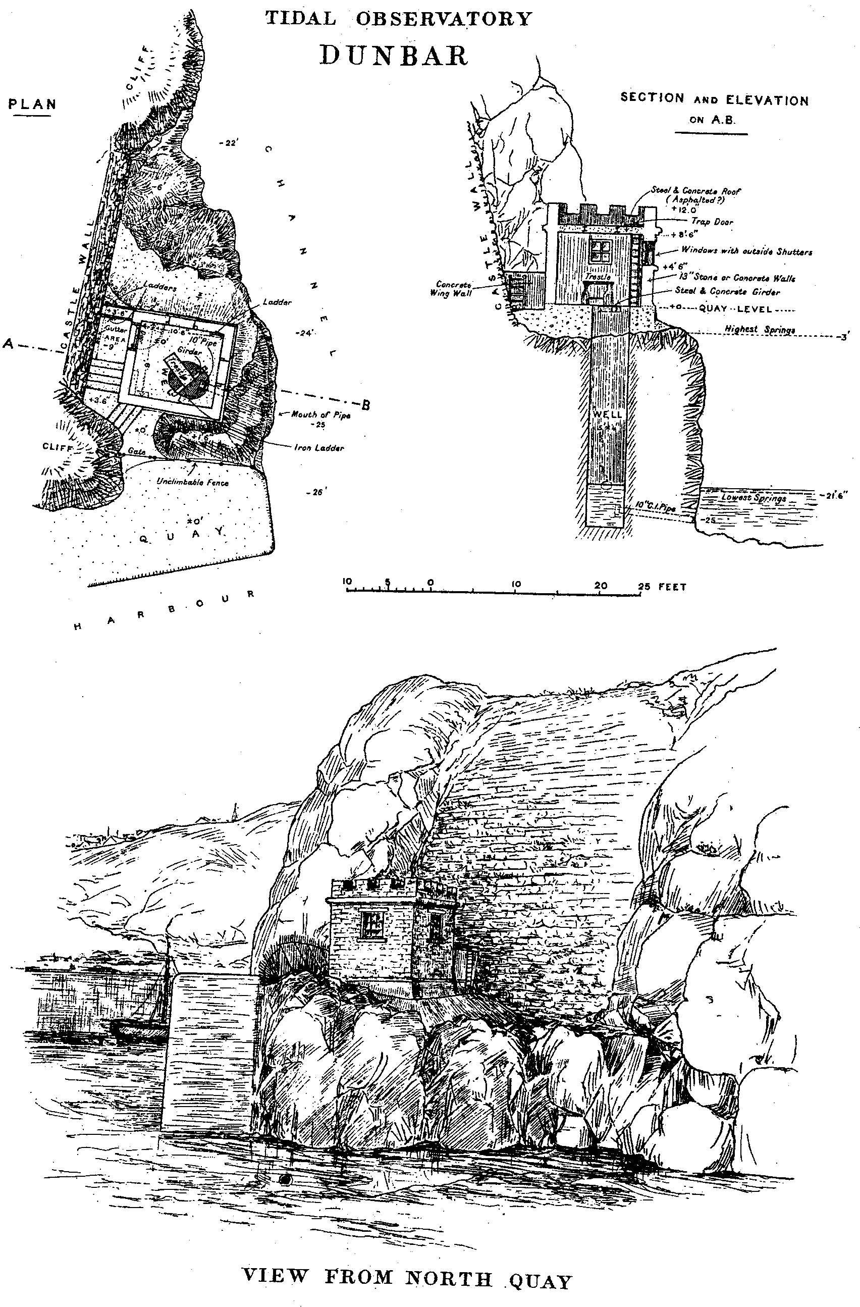
| XII | Dunbar Tidal Observatory | ||
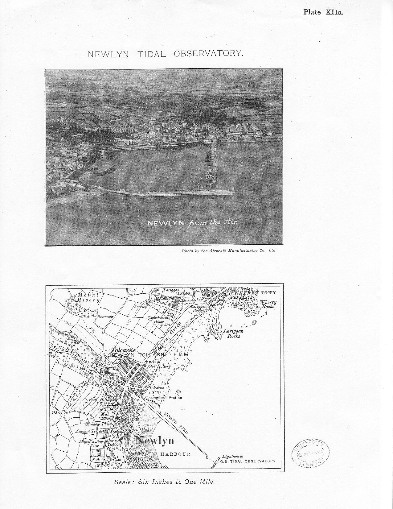
| XIIa | Newlyn Tidal Observatory | ||
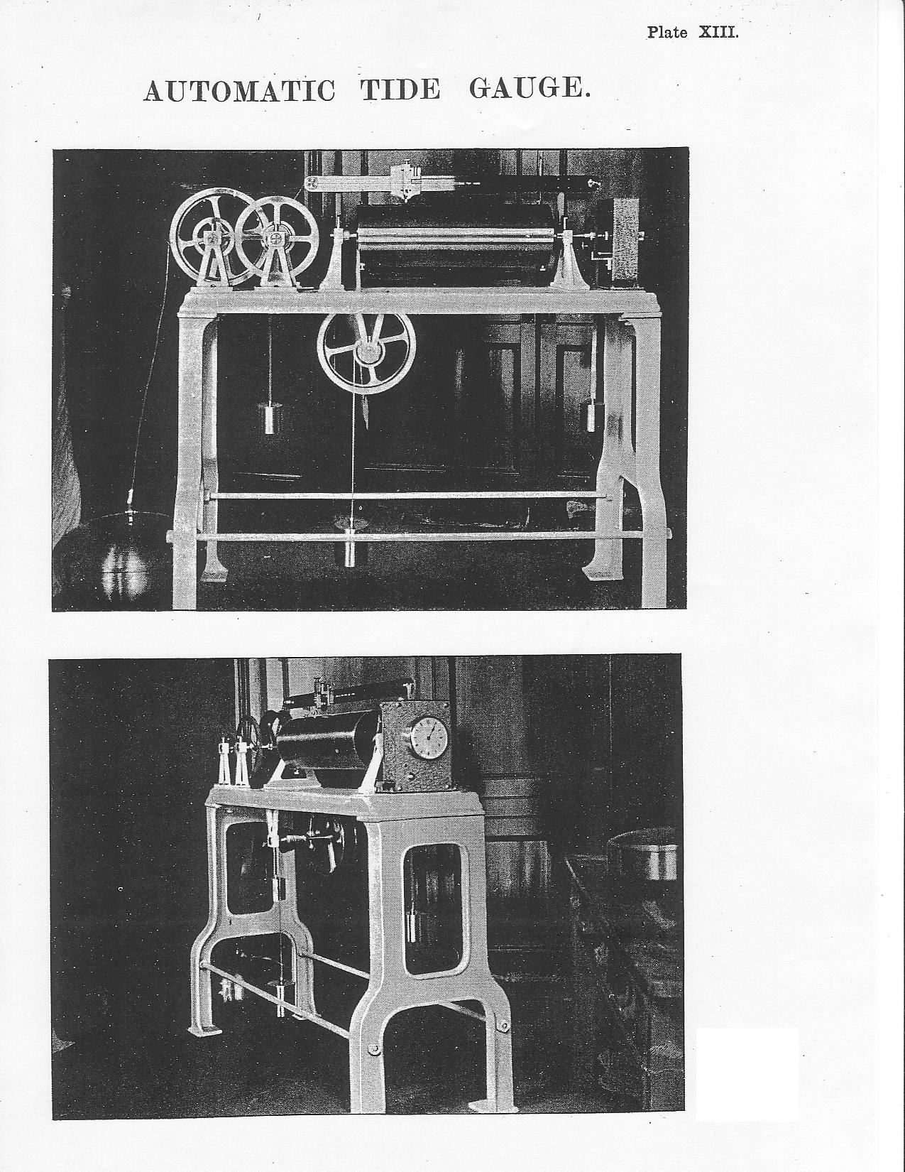
| XIII | Automatic Tide Gauge | ||
| XIV to XX | Sea Level Curves [not scanned ...] | ||
| XXI to XLII | Error Curves [not scanned ...] | ||
| XLIII to XLVI | Reduction Equations [not scanned ...] | ||
|
* The initials are those of the writers of the respective chapters: AJW standing for Lieut.-Colonel A.J. Wolff, DSO, RE, and HLPJ for Mr H.L.P. Jolly, MA |
|||