![]()
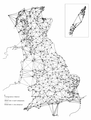
This map shows the Rays observed in building up the Primary Network of Trigpoints that the OS measured between 1935 and 1967
Hi Res Version (99kb)
We NOW know
that this map is a combination of Primary Stations from the Re-Triangulation of
Great Britain (1935-62) AND a few extra ones from 'Readjustment of the
Triangulation' (1962-67).
This 'Readjustment of the Triangulation'
introduced a few extra stations to strenghen the network in a few places where
it was particaully weak. This is in two areas, one around Liverpool &
Blackpool and another around East Yorkshire. Also a new link with France was
established south of Isle of Wight and Portland, this link made use of new
advances in radio technology that allowed large distances to be measured with a
Tellurometer . (more here)
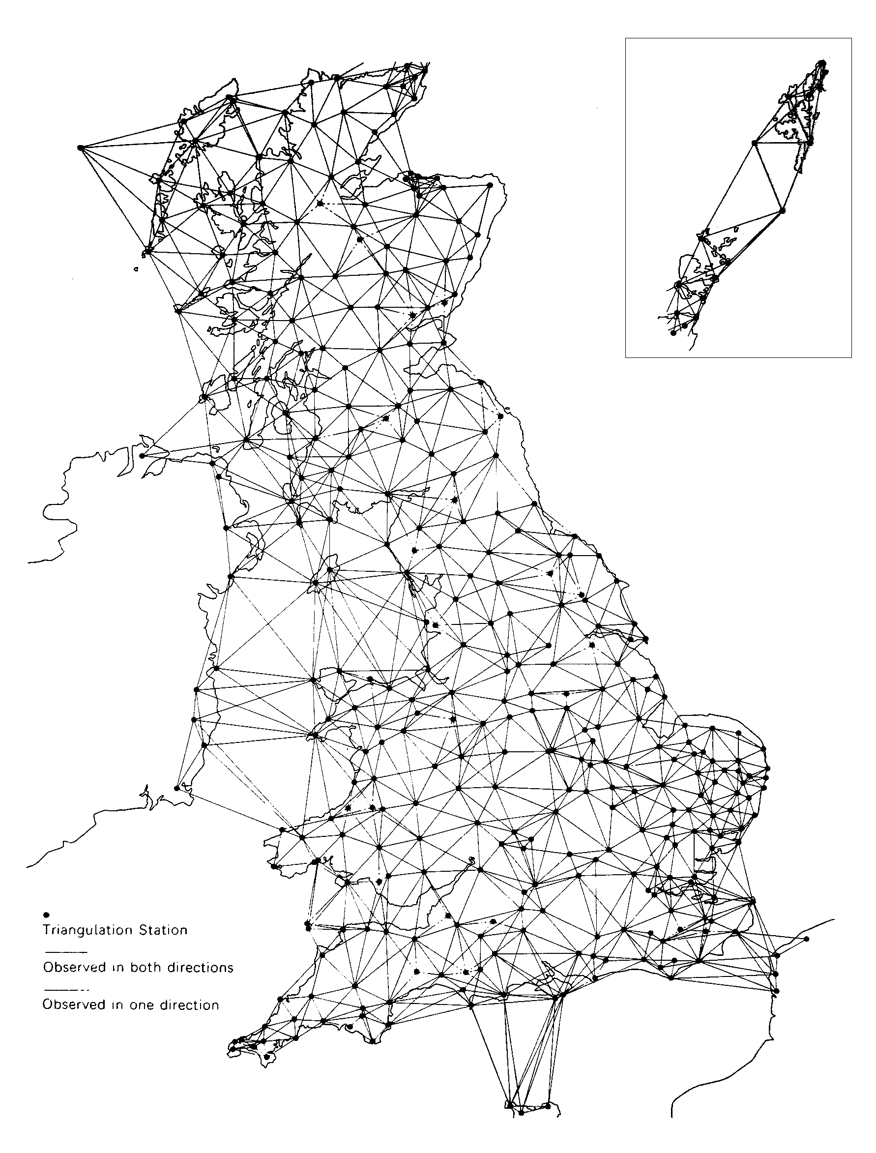
See
Overlayed Map which
overlays the Primary Trigpoints from Re-Triangulation of Great Britain
with this combinded map. This shows that a few stations didnt exist as Primarys
when the Re-Triangulation of Great Britain was carried out but where later to
gain Primary Status during the Readjustment. More on the individulal stations
here
See also a Intereactive map of primary startions and how Primary Stations where used to define Secondary Blocks
This is made available here purely for research purposes, and should not be duplicated or redistributed.
This is Figure 3 From 'Ordnance Survey Maps - a descriptive manual' by J B Harley which was published by the OS in 1974.
“Reproduced by kind permission of Ordnance Survey © Crown Copyright NC/2004/35281”
This page created by Barry Hunter (c)2004 part of Trig Tools