
Levelling
of Great Britain
[2GL Transcription]

|
Ordnance Survey's Levelling of Great Britain |
[2GL Abstract] [2GL Transcription] |
|
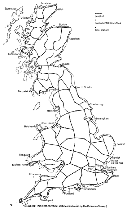
This map shows the Primary Lines measured during the Third Geodetic Levelling
Hi Res Version (64kb)
See also the Intereactive map of 3GL - built using this map!
We have also found some documents about 3GL in Scotland, but includes some similar maps for Endland and Wales
Seems to be as a (low-res) version at [pol.ac.uk/ntslf] (incorrectly labelled as 'first half of the 1900s', when actully its 3GL from '50s)
This is made available here purely for research purposes, and should not be duplicated or redistributed.
This is Figure 4 From 'Ordnance Survey Maps - a descriptive manual' by J B Harley which was published by the OS in 1974.
“Reproduced by kind permission of Ordnance Survey © Crown Copyright NC/2004/35281”
This page created by Barry Hunter (c)2004 part of Trig Tools